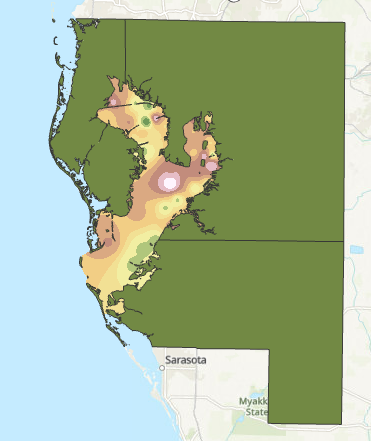
Interpolation is a method for calculating a gradient of change across a surface using point data. There are multiple different interpolation techniques that can be used to create these surfaces that each have their own pros and cons. For this particular assignment, we had to use ArcGIS to produce interpolation surfaces using Thiessen polygons, IDW, and two different types of Spline interpolation (Regularized and Tension).
The Thiessen polygons method creates polygons around a single data and applies the value of the point to the polygon. The IDW, or inverse distance weighted method, determines values by taking into account how close points are. The further away a point is, the less this method takes into account its value when determining the value of a particular cell. The spline method works likes a pliable sheet that bends itself through each one of the provided data points. A regularized spline creates a smoother surface than a tension spline, as a tension spline is more constricted by the values provided by the data points.
No comments:
Post a Comment